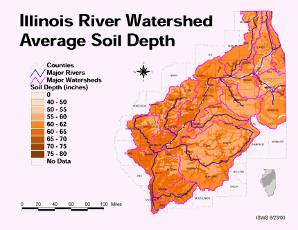
 This shows the average soil depth for the Illinois River Watershed area. It shows that the soil depth is deeper in the southwest part and along major watershed areas, and shallower where there are not many major watersheds (with small exceptions).
Subscribe to:
Post Comments (Atom)

No comments:
Post a Comment